|
Sierra High Route
July 27 - August 5, 2013 Peter Bakwin & Flyin' Brian Robinson Iĺve done quite a bit of backpacking and running in the Sierra, including doing the complete JMT 3 times. The SHR seemed like a logical next step. For me, Flyinĺ Brian was the obvious and perfect choice for a partner. Weĺd hiked together before and got along very well. And, of course Brian is one of the most accomplished and experienced backpackers on Earth. Plus, he knows this area extremely well. I have a great deal of experience with off-trail hiking and mountaineering, and happen to be very good at rock hopping and micro route finding in complex terrain. I figured weĺd make an excellent team for the SHR, and I think we did. We had allocated 9.5 days to the hike. Nominally, I figured 16.5 miles (to Horseshoe Lakes) the first day because of a late start, heavy packs and the huge 6000ĺ vertical climb right out of the gate. We wanted to finish early enough on the 10th day to thumb into Bridgeport and catch the CREST bus down to Lone Pine to meet my wife after her JMT hike, so I gave us 10 miles for that (half) day. That left a quota of 21 miles per day for the rest of the trip. We knew, of course, that some days would be harder with more off trail hiking, and some days would be easier ľ we just wanted to establish targets to keep ourselves on track overall. I flew into Fresno, was picked up by Brian, and we drove to John and Marcia Rasmussenĺs home in Squaw Valley ľ they were kind enough to put us up for the night & give us a lift to the trailhead early in the morning. We had a nice dinner with them, reminiscing about various adventures. Marcia had just completed Vol State, a 310-mile race across Tennessee (in July!) and it was cool to share experiences of multiday running. Day 1: Copper Creek TH to low point between Gray Pass and White Pass (19.5 miles, 19.5 miles total) Early on the morning of July 27 John and Marcia dropped us at the Copper Creek Ranger Station, where we picked up our permit as a light rain fell. Rain was welcome at this point, since we were starting at a low altitude (5000ĺ) with that big climb. We started walking about 7:20 a.m., ascending steadily in refreshingly cool drizzle and cloud. With 6 days of food the packs seemed heavy, but the miles went by quickly on the gradual trail. I wasnĺt sure what the availability of water would be on this section, but there were plenty of small streams crossing the trail, even in this very dry year. 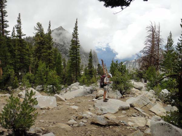 Brian gets down to navigation after leaving the Copper Creek Trail 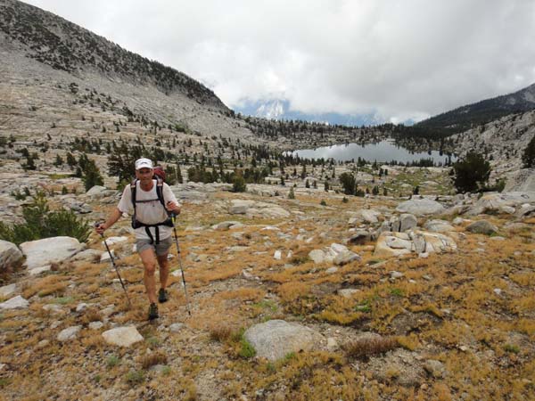 Above Grouse Lake 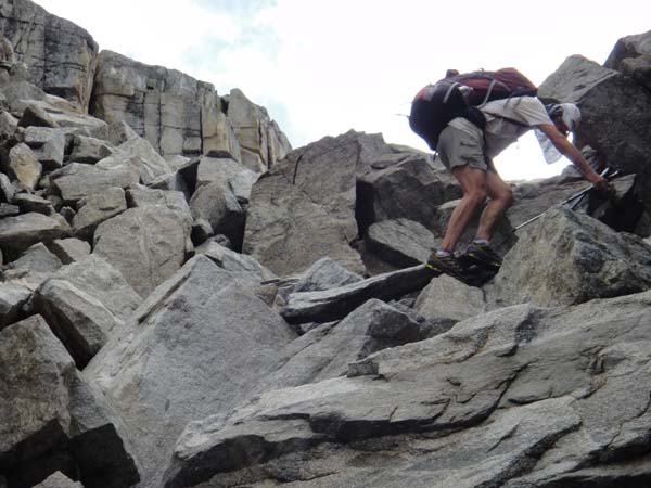 Intro to Sierra talus hopping Leaving the trail after about 7 miles, Brian made off-trail navigation in the trees seem easy. We went over Grouse Lake Pass and Goat Crest Saddle, and arrived at Horseshoe Lakes earlier than expected, so pressed on over Gray Pass. With our heavy packs and un-tested legs, we were definitely getting tired by the time we got over Gray, so decided to camp somewhat early (before 6 p.m.) in the lovely, verdant valley between Gray Pass and White Pass. We had done about 19.5 miles, 3 miles over our quota for the day, and were pleased to have some miles in the bank already. 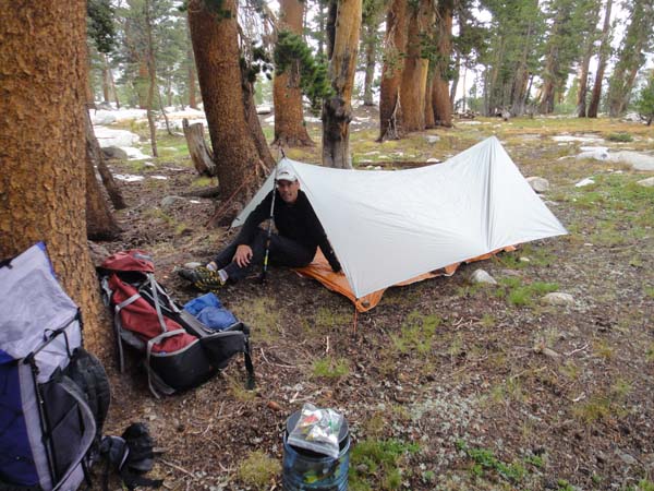 First Camp For shelter we had Brianĺs 8 oz Gossamer Gear Spinn Twinn tarp (great 2 person shelter!), plus head nets for bugs. The night was warm and mosquitoes were driving me nuts. Neither of us was getting much sleep as I thrashed around, trying hunker down in my sleeping bag to avoid the bugs but then getting way too hot. Finally Brian suggested the simple solution of getting out of my bag, and putting on my rain jacket against the mozzis. This worked great (along with my head net) and we were finally able to get some sleep. Fortunately, this was the only night on the SHR where we were bothered by bugs. Day 2: to Barrett Lakes (18.3 miles, 37.8 miles total) Our second day was perhaps the hardest of the trip. We went over 6 high passes ľ White, Red, Frozen Lake, Mather (on the JMT), Cirque and Potluck ľ and the route was mostly off trail. Plus our packs were still heavy with 5 days of food on board. Frozen Lake Pass was especially tough ľ steep, gnarly talus on both sides. Brian suffered especially with his heavier pack (Iĺd worked hard to get my pack weight down and was bordering on what Andy Skurka calls ôstupid lightö) and lack of acclimation to the altitude (Brian lives at sea level, while I live in Colorado). Cirque Pass turned out to be much tougher than either of us expected ľ steep and slabby and challenging to find the best line, but also very aesthetic hiking. We soldiered on and made it to Barrett Lakes in upper Palisade Basin. Weĺd done only 18 miles for the day, but felt weĺd earned every one. This route was starting to feel intimidating and we wondered if our 9.5 day goal was too ambitious, though we were still on our ônominalö schedule. 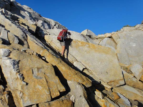 Slabby terrain between White Pass and Red Pass 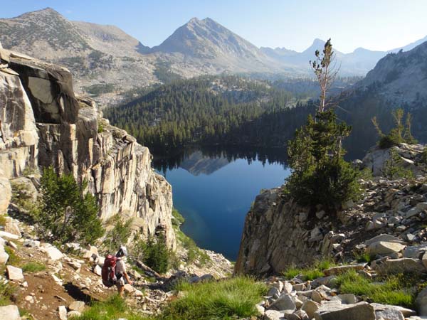 Marion Lake 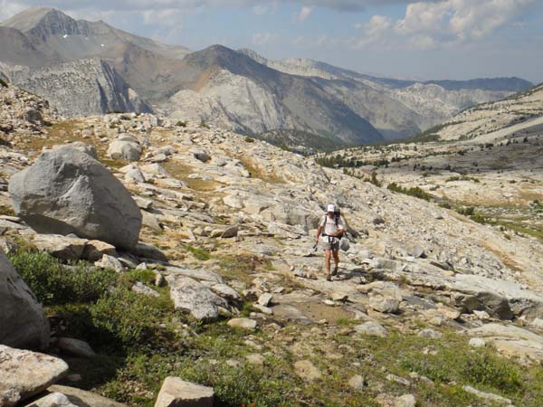 Cruiser terrain in Lake Basin 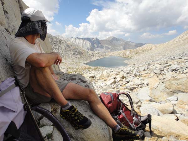 Chillinĺ below Frozen Lake Pass 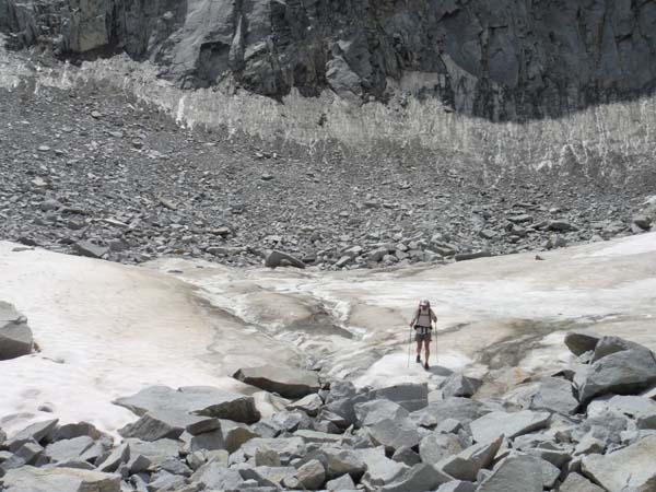 Dropping off Frozen Lake Pass into Upper Basin 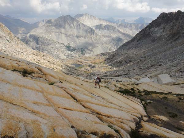 Cranking up Cirque Pass 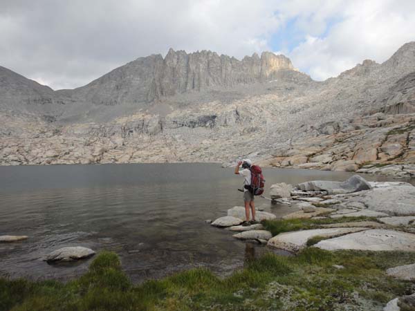 Unnamed lake between Cirque Pass and Potluck Pass The evening was clear so we didnĺt put up our tarp. By 10 p.m. our sleeping bags were soaked with dew. I tried to move as little as possible to avoid compromising the insulation of the down bag. But, at 11,500ĺ and with a wet bag it was still a chilly night! Day 3: to upper basin below Snow Tongue Pass (24.8 miles, 62.6 miles total) We popped over Knapsack Pass first thing in the morning, then down into gentle and pretty Dusy Basin. When we reached the Bishop Pass Trail Brian was ready to put the hammer down and get some miles in the bank. We had a lot of trail coming up, so this was time to build some cushion on our daily miles. Brian hikes quite fast on trail, so in many ways these trail sections were more challenging for me than the off-trail parts. We dropped a couple thousand vertical feet into LeConte Canyon, then felt the heat of the day as we cranked up towards Muir Pass. Iĺve always found this to be one of the beautiful sections of the JMT, with the lovely creek, and waterfalls cascading down the sides of the canyon. We took a Ż hour break along the way up to dry out our gear from the previous dewy night and to wash a little, but otherwise it was all business until we finally reached the outlet of Evolution Lake. This was our nominal camp for the day, but since it was still early we pushed on across the interesting ôside hillö section, as the Evolution Valley dropped away below us. Brianĺs navigation was flawless, and we were able to take a slightly shorter route than marked on Skurkaĺs map, cutting the corner to bypass the large lower lake in the basin below Snow Tongue Pass. We found a serviceable camp site near the shores of the upper lake, about Ż mile below the pass. It had been a long and productive day, and with the big trail miles had put us once again a little ahead of schedule. To keep any dew off our sleeping bags we put up Brianĺs tarp for the second and last time of the trip. Day 4: to Upper Mills Creek Lake (22.5 miles, 85.0 miles total) We had a lot of off trail travel in store for us on this 4th day, and we knew it would be a test of our ability to stay on schedule. The packs were getting lighter, and we were settling in to the long daily schedule and the miles of rock hopping, so we were optimistic, but I think we both wanted to do well this day and finally be able to relax around the schedule. And it went extremely well. 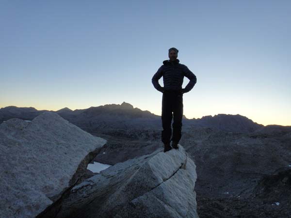 Early morning on Snow Tongue Pass We cranked up the infamous Snow Tongue (ôSĺno Funö, I called it), and down the exceptionally loose and steep northeast side (without a trace of snow). This was followed by a lengthy section of rock hopping to pass Wahoo Lakes. Travel in Humphreyĺs Basin was much easier, and Brian found us an efficient line up to Puppet Pass and then down the other side into French Canyon. A short, easy trail section led us to the very steep trail up to Merriam Lake (note that we found the Merriam Lake trail just after crossing the creek, not before the creek as indicated on the map), which we bypassed to the east, cranking up the long climb to spectacular Feather Pass. 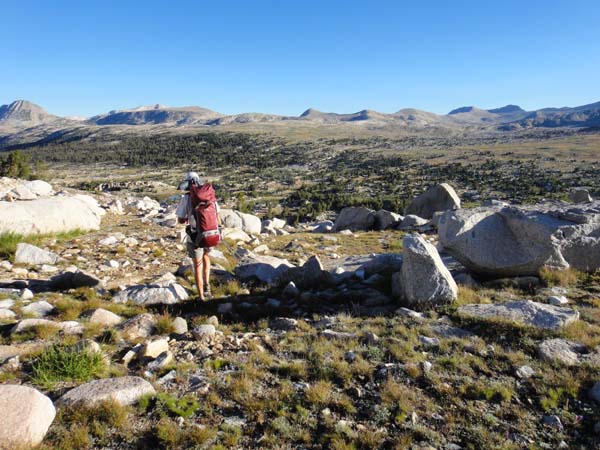 Humphreyĺs Basin We were on a roll, and made short work of the pretty Bear Lakes area, though slightly botching the best line up to White Bear Lake. Based on tiredness and distance we figured on camping at the east end of Lake Italy, near Toe Lake. But, the hike around Lake Italy was easier than we expected, and the camping around Toe Lake was unappealing ľ stagnant water and kind of desolate. So, with hardly a word we just kept marching on up Gabbot Pass, our fourth off-trail pass of a long day. The ascent was easier than we expected, with good footing on nice ôSierra sidewalkö, but the descent to Upper Mills Creek Lake was long and arduous, with plenty of classic SHR rock hopping. We finally flopped down on the grass near the lake around 7:30 p.m., happy to be done and to have put another mile or two in the bank on this tough, 14-hour hiking day. Our camp was by yet another stunning alpine lake without any sign of humanity ľ beautiful. We had a cool, dry night under a dizzyingly starry sky. 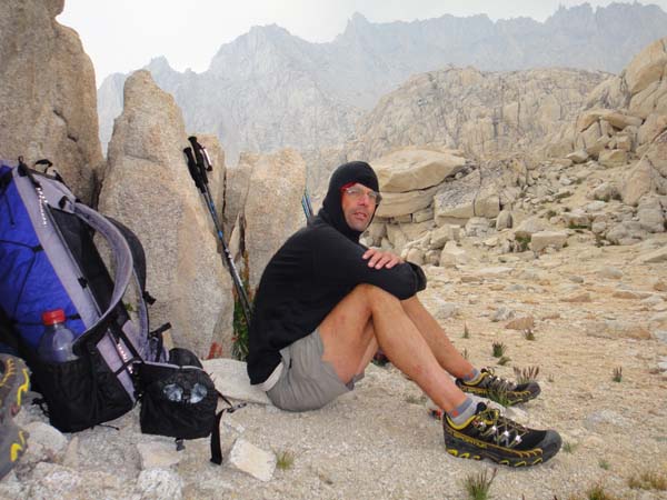 Pass near White Bear Lake 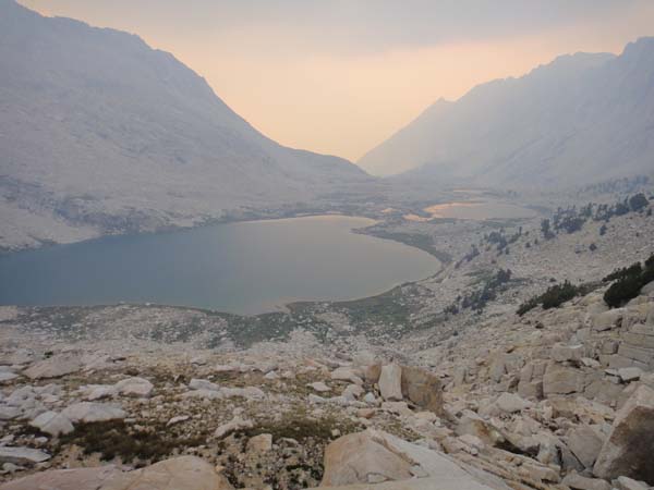 Fire haze at Upper Mills Creek Lake 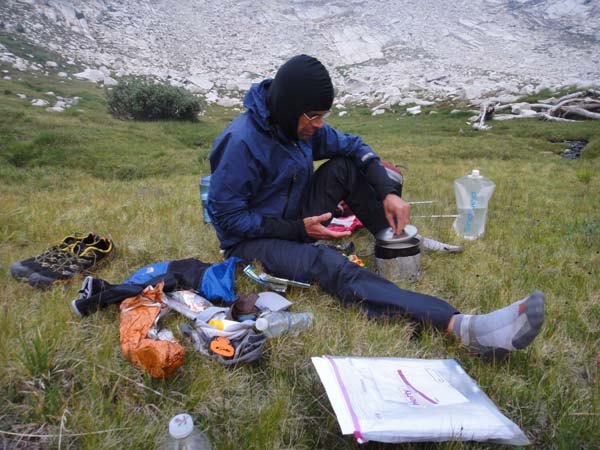 Camp at Upper Mills Creek Lake Day 5: to upper Deer Lake (24.3 miles, 109.3 miles total) 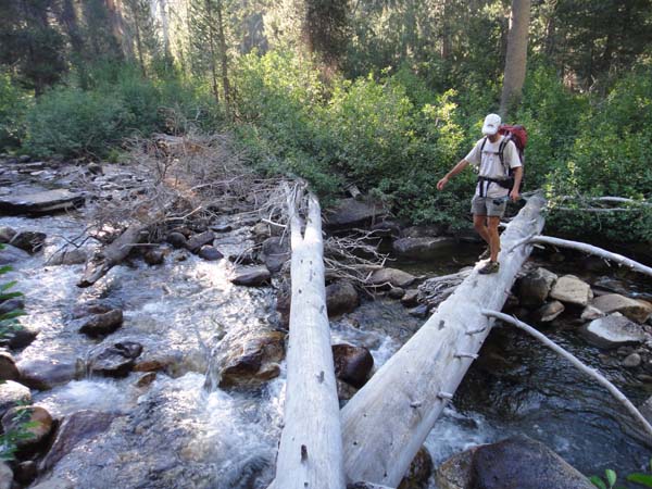 Descending Mills Creek 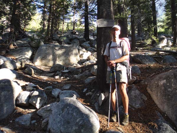 Crossing Mono Creek It seemed like a long, steep way down until we finally picked up the good trail in the Second Recess. But, it was also super scenic as we descended next to a creek that cascaded over granite slabs. After a few steps on the Mono Creek Trail we started cranking up through the Manzanita on the Laurel Creek Trail. The trail disappeared into a meadow after the initial steep climb, and we just kept following the drainage on up, navigating through some jumbles of trees that had been knocked down by avalanches. Bighorn Pass afforded an amazing view of Rosy Finch Lake, and then we had a tedious traverse over to Shout-of-Relief Pass. We briefly considered taking the trail along Fish Creek (where Skurkaĺs map says ôTempting to follow trail hereö), but Brian argued that this is the SHR and that means we go off trail where possible. So we stayed further south, around Cotton Lake and pretty Isaak Walton Lake before finally dropping down a complex, brushy drainage into Horse Heaven, where we picked up good trail once again. 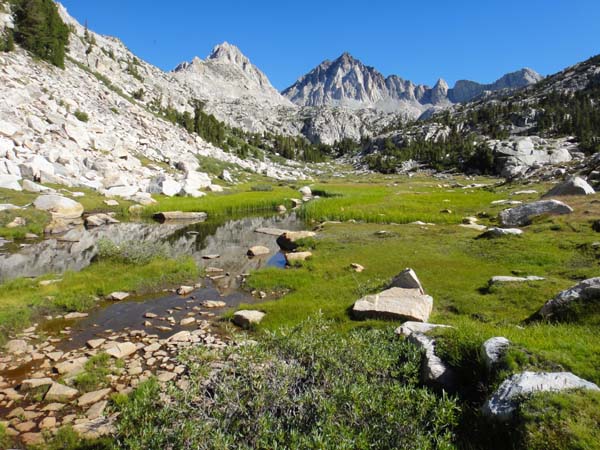 Laurel Creek Getting on the JMT at Tully Hole felt absolutely urban compared to where weĺd been. There were lots of SoBo hikers, and it seemed like every other one wanted to stop and chat about something. There were some elderly hikers looking for their mule train, some Koreans whoĺd lost one of their group, and people who just wanted to talk. Hard to imagine how a NoBo JMT thru hiker could make any progress. We pressed on along the easy trail past Lake Virginia and Purple Lake, then cranked up the gradual grade to Duck Pass where we left the trail to follow the Mammoth Crest a while. The lack of landmarks up there made navigation a bit tricky, and it took us some puzzling to figure out the route off the Crest to Deer Lakes. But we eventually made our way down a surprisingly steep trail to a nice camp site by the upper-most Deer Lake. It was a long and satisfying day that put us a comfortable Ż day ahead of our nominal schedule. Day 6: to Iceberg Lake outlet (21.5 miles, 130.8 miles total) 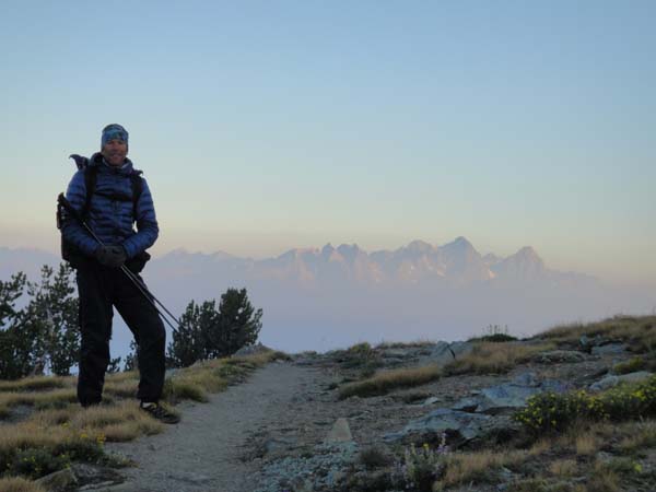 Morning on the Mammoth Crest 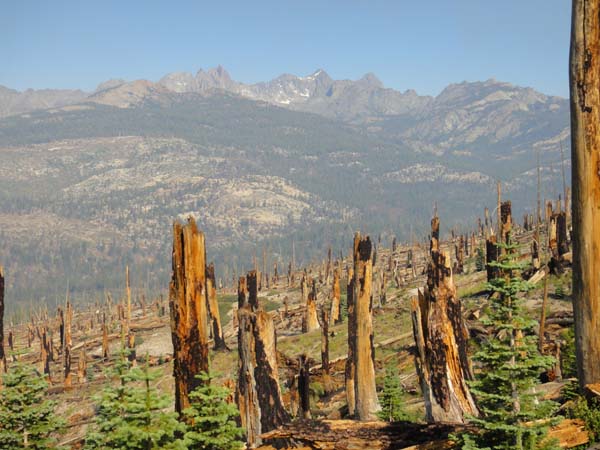 Descending into Reds Meadow Our first objective for the day was Reds Meadow and our resupply. We reached the store mid-morning, retrieved our box, and plopped down in the cafÚ for a big plate of eggs, &c., served by a pretty young waitress. With all the ôregularö people around, for the first time on the trip I felt conspicuously filthy in comparison. We spent maybe 90 minutes at Reds, a welcome respite, but then were back on a now hot, dusty trail, which had been pulverized to sand (mixed with horse shit) by many hooves. It was unpleasant going particularly until we got off the JMT, but also a pretty loose surface heading up the Beck Lakes Trail ľ a long and tedious climb. We finally made it to Superior Lake and stopped to wash our feet and socks. We were relieved to be going off trail again, but the super steep ascent of Nancy Pass soon had us rethinking that position ľ with the newly heavy packs it just seemed hard. Still, going up was tame compared to the descent off Nancy, which was literally dangerous with all the loose rock ľ I think the most dangerous spot on the SHR. Nancy Pass (Brian called it ôNasty Passö) really seems superfluous ľ it would make a lot more sense to go up the Minaret Creek Trail and skip the whole thing. Still, there was a terrific view from the pass itself. The traverse across the basin to Minaret Lake turned out to be tricky navigation, with lots of cliffy areas to work around in the trees. But eventually we joined the Minaret Creek Trail just below the lake as afternoon began to stretch into evening. The views were certainly as spectacular as anything on the SHR as we worked around Minaret Lake and up the interesting scramble up to Cecile Lake. The ôtrailö down to Iceberg Lake was not very good, but certainly easier than the usual endless rock hopping. There was a sizeable party camped near the outlet of Iceberg, but we found an excellent site, sheltered by trees, a few hundred yards down, just where the SHR leaves the main trail again. I tucked myself under a tree for maximum warmth and had a very comfortable night. 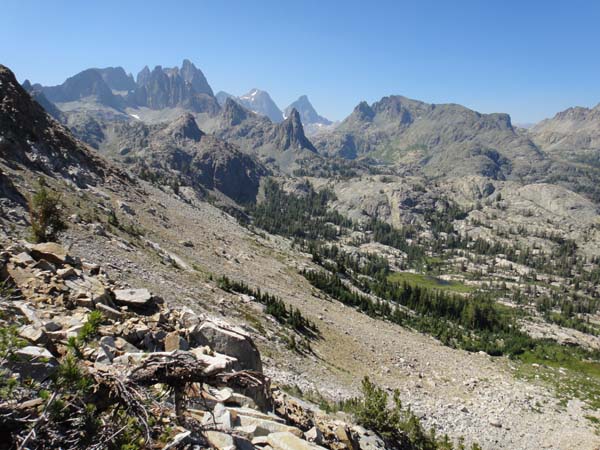 View from Nancy Pass 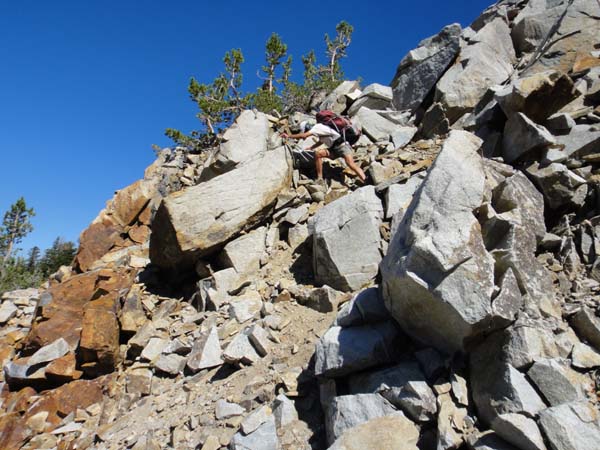 Descending Nancy Pass 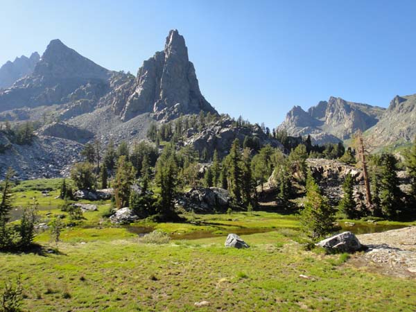 Approaching Minaret Lake 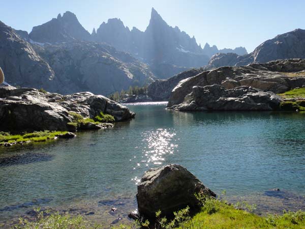 Minaret Lake 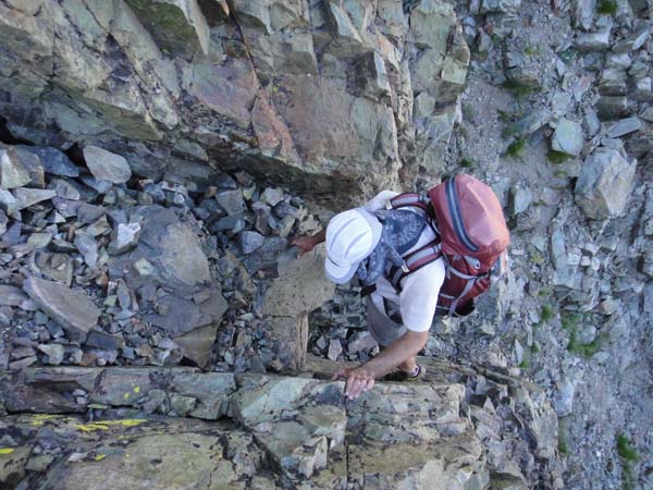 Class 3 step above Minaret Lake 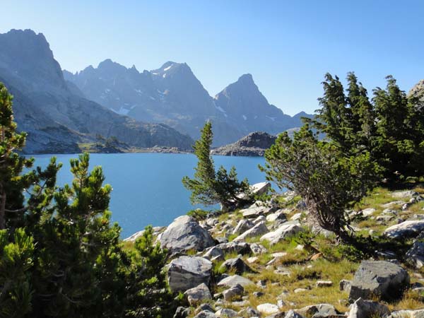 Lake Cecile 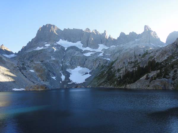 Iceberg Lake 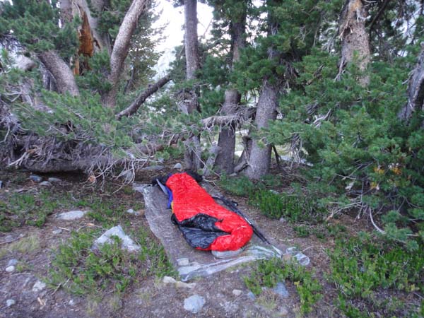 Camp below Iceberg Lake Day 7: to Isberg Pass Trail on bench above Lyell Fork (20.2 miles, 151.0 miles total) 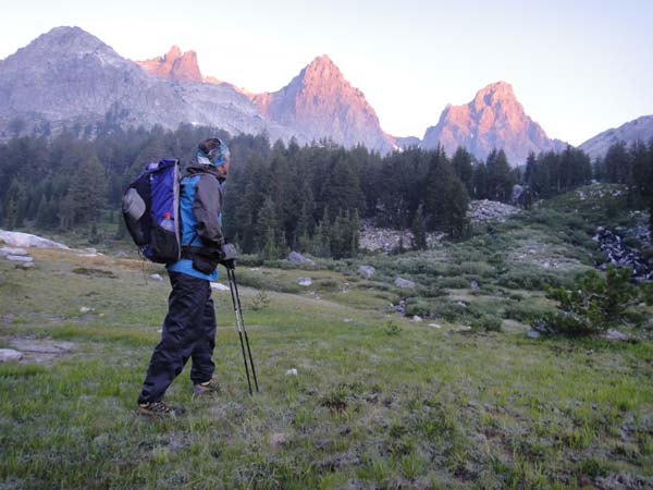 Sunrise on Mt Ritter & Banner Peak 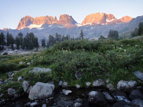 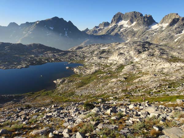 We were up for our usual 5:30 a.m. start. It was relatively easy off trail hiking up and over Whitebark Pass, over the unnamed pass between the west ends of Garnet and Thousand Island Lakes, and up North Glacier Pass. On the west side of North Glacier we were treated to some of the most amazing and interesting terrain on the entire route ľ I think from North Glacier to North Twin Island Lake might have been my favorite section of the hike. The drainage descended over various cliffs, producing both spectacular cascades and interesting scrambles to work oneĺs way down. The route descriptions Iĺd copied out of Roperĺs guidebook were particularly helpful here. The going was slow, but we took our time and enjoyed the terrain. 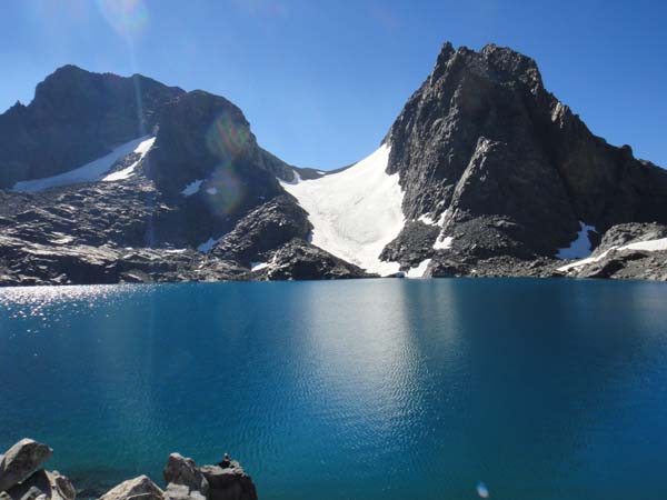 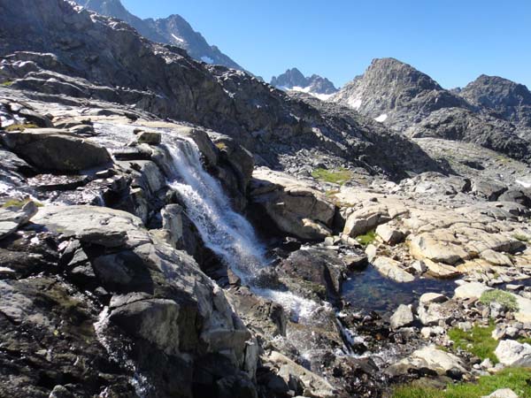 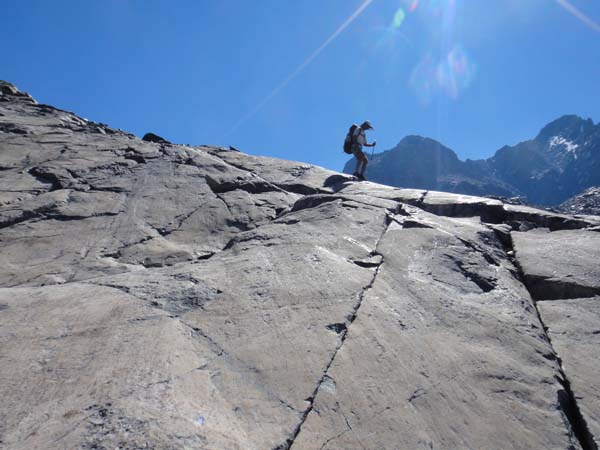 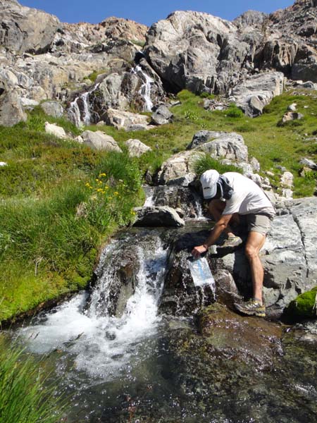 We had a nice lunch break at North Twin Island Lake before continuing on through more interesting terrain and somewhat complex navigation. Brian was once again spot on in getting us down into Bench Canyon and up to Blue Lake Pass. After an easy traverse, finding the Iseberg Pass Trail proved tricky. Roper says itĺs easy to miss, so we werenĺt sure as we bumbled around in the trees. I pulled out my GPS for the first time on the trip, but the waypoint I had for the trail turned out to be quite a ways from the actual position of the trail on the ground. If weĺd just kept walking west we would have certainly stumbled across the obvious trail, but we wanted to be sure we didnĺt miss it, so spent some time evaluating our position. Anyway, we did find the trail pretty quickly once we were sure we hadnĺt walked by it. 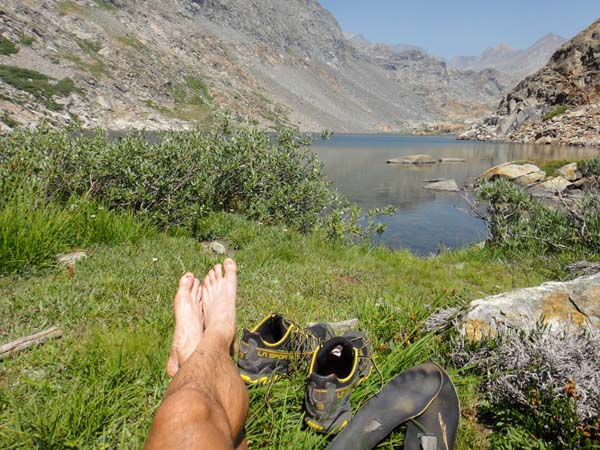 North Twin Island Lake The day was wearing on, but when we got the bottom of the canyon of the Lyell Fork the mosquitoes were thick, so we pressed on up to the bench on the north side of the canyon. It was cool to finally be in Yosemite! We found a pretty good, bug-free camp site in the trees, close to a side stream 2-3 miles along on the bench. It had been a long, tough day almost entirely off trail, but weĺd managed to give up less than a mile of our buffer. Day 8: to Alpine Lake (26.0 miles, 177.0 miles total) Mostly fast (Brian is FAST) hiking on easy trails. There wasnĺt much reason for breaks, so we just motored along all the way to Tuolumne Meadows ľ not terribly interesting hiking by SHR standards. We stopped briefly to text my wife, who was hiking the JMT NoBo and it turned out would be through Tuolumne in just another 1-2 hours! (She & partner hiked 22 miles into Tuolumne, ditched their packs in a bear box, and ran down 25 miles into the Valley for a 47 mile last day, finishing the JMT in around 7 days and 9 hours!) We pushed on through, up the Granite Lakes Trail and over to the Great Sierra Mine. It was Saturday and there were tons of people out hiking everywhere. The route closely parallels a road all the way up to Cascade Lake, so there were lots of people out hiking and swimming in the lakes, and the feel was decidedly less remote than weĺd experienced for most of the trip. For a few days we had been talking about what to do with our extra time, now that we were about Ż day ahead of schedule. We settled on the idea of climbing Mt Conness (12,590ĺ), the highest peak in northern Yosemite, but werenĺt sure about the route up from the east side. Serendipitously, we got chatting with a passing day hiker near Spuller Lake who happened to be very familiar with the area. Though his directions were somewhat inconsistent, we were able to glean that it is possible to climb Conness from Alpine Lake if you can find the right notch to penetrate the southeast buttress and gain access to the gentle summit plateau. Armed with this information, we decide to give it a go from a high camp at Alpine Lake. After a long day of trail hiking, the steep, brushy, 1000ĺ vertical climb to the lake was quite a grunt. But we were rewarded by solitude (once again) and a fine camp site in a stunning setting by yet another pristine mountain lake. Day 9: to upper Spiller Creek Drainage (11.0 miles not including side trip to Mt Conness, 188.0 miles total on the SHR) We started the day by schlepping our packs up a short climb to the bench above Alpine Lake, where we hung them off a big rock to secure them against marmots. Hiking unencumbered was a joy as we went off to try to find a way through the intimidating cliffs in the cirque above Alpine Lake. Our first attempt was too low on the southeast buttress, and only resulted in our gaining the crest of the buttress, with no obvious way through to the plateau. The second attempt was too high, and Brian felt it was entirely too precipitous. Our third try took us up a steep dirt slope that went easily up to the ridge, leaving us on a complex but just-maybe-doable part of the Southeast Buttress. Further scouting eventually revealed an easy (class 3) line up through the final cliffs, depositing us on the summit plateau at about 12,300ĺ. From there it was a stroll across the plateau and up the interesting surveyorĺs trail to the summit. We caught up with a couple of hikers at the start of the final rocky pitch to the summit, and one of the hikers greeted Brian by name. It turned out to be an old hiking acquaintance of Brianĺs who, amazingly, we had also run into at random on the JMT last year! The view from the top of Conness was certainly one of the best of the trip ľ expansive vistas in every direction. It was immediately clear why this peak was so important for the surveyors. 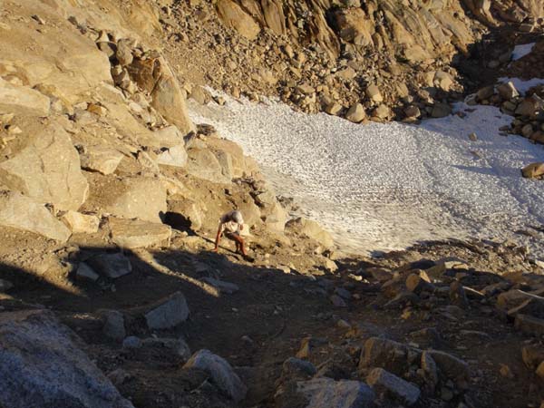 Steep dirt on the climb to the SE Buttress of Mt Conness 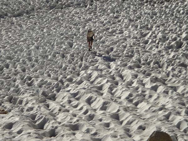 Ascending Mt Conness 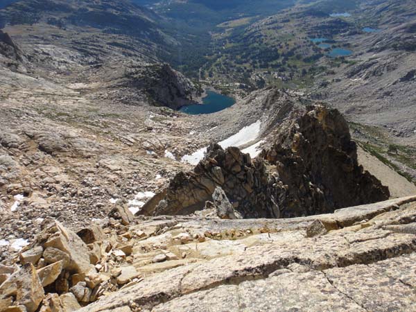 SE Buttress and Alpine Lake from the summit plateau of Mt Conness 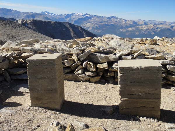 Surveyorĺs stands on Mt Conness 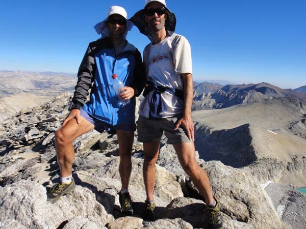 Summit shot! 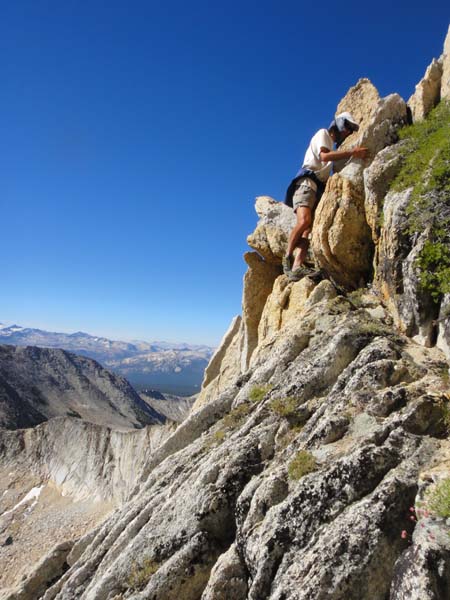 Downclimb on Mt Conness 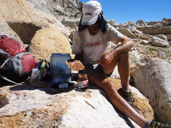 Brian fuels up after the climb on Mt Conness The return to our packs was fairly quick, but we had still spent nearly 5 hours on the side hike, and we wanted to get quite a few SHR miles in yet. After a snack, we loaded up and took off across a high bench, meeting back up with the nominal SHR route at around 11,200ĺ on the east shoulder of Conness. We zig-zagged down interesting slabs and ledges to Conness Lakes, then climbed over the east shoulder of North Peak. From Cascade Lake we admired the imposing north face of North Peak, which surely must inspire some serious mountaineering interest. We talked of a future peak-bagging trip to the region. 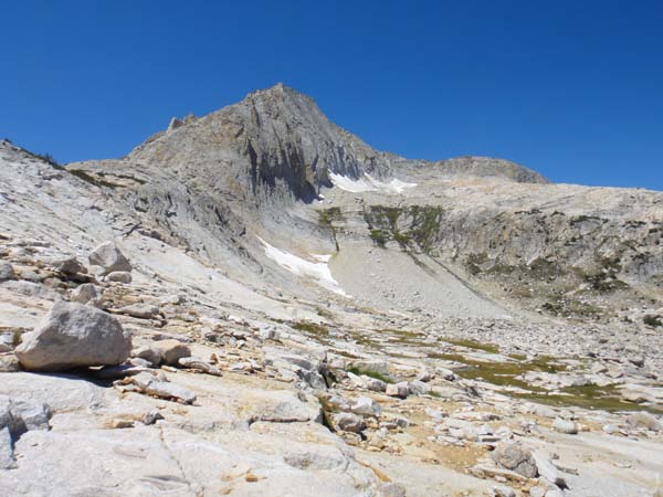 North Peakĺs imposing north face A nice use trail took us from Cascade Lake to the base of a long gravel and scree slope up to Sky Pilot Col. The long climb was steep, loose and difficult, especially on top of our morning excursion. The descent off Sky Pilot was truly awful ľ very steep sand and gravel on top of a hard surface made for tricky, quasi-dangerous conditions. I scurried down as quickly as I could to get out of range of any rocks that Brian might inadvertently set rolling down the slope. The bad part was mercifully short, and then we were back on the usual SHR rock hopping for a bit, then route-finding through a brushy area, then into the trees b-lining to towards Grey Butte. Brianĺs navigation into and out of Virginia Canyon was again spot on. Climbing up to Soldier Lake, while long (1700ĺ vertical) and steep, was on delightful slabs ľ really lovely and pretty easy hiking (though UP). It felt like after a full day and a half we were finally back on classic SHR terrain. 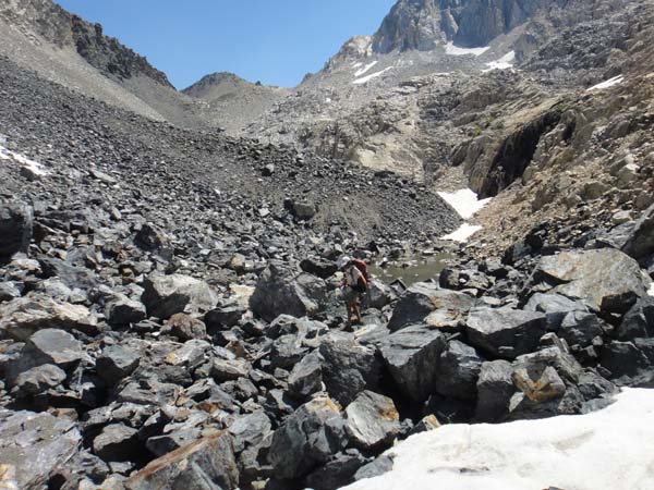 Jumbled mess of talus after Sky Pilot Col 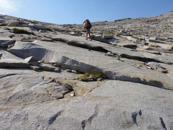 Nice slabs below Soldier Lake 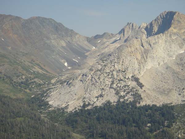 Looking back at the Shepard Lake Drainage Once on top of Stanton Pass it just seemed like a long way down into the valley. We were tired, but a nice dinner and bed for our last night on the SHR beaconed below. We dropped carefully into Spiller Creek, and found a serviceable camp site less than a mile below Horse Creek Pass. What a day! 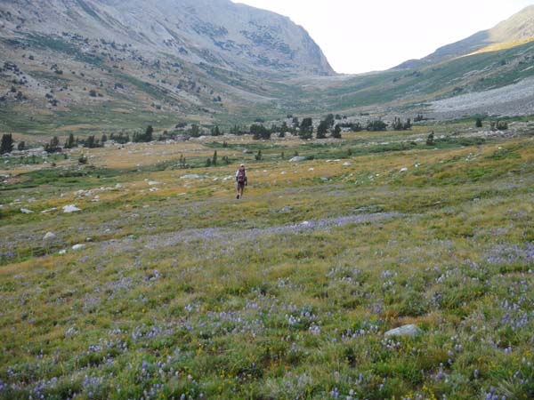 Evening in Spiller Creek drainage Day 10: to Horse Creek Trailhead (7.0 miles, 195.0 miles total, SHR in 9d2h) We were in no hurry, but still got going at our usual 5:30-5:40 a.m. ľ our bodies were just used to it. We made short work of the easy climb up to Horse Creek Pass. We briefly considered climbing Matterhorn Peak, which looked short and not too hard, but, well, we were ready to just finish off the route and find a shower somewhere, so we kept going over the pass. The descent off the north side was surprisingly rough at first ľ plenty of rock hopping! ľ but gradually eased off and we finally found an increasingly good trail for the long, 3700ĺ vertical downhill to Twin Lakes. We popped out of the woods at a campground, densely packed with RVs ľ surreal. 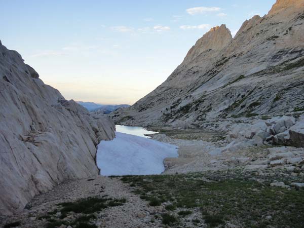 Hoofing it over Horse Creek Pass  Done! 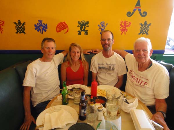 Back in Lone Pine with Stephanie, Flyinĺ Brian and Ben Jones Summary: The SHR is an amazing, super spectacular and TOUGH route. If you are not quite good at both off trail navigation and ROCK HOPPING this is going to be a long and difficult trip. The SHR really isnĺt intended to be a thru hike, but rather a means to visit a bunch of very cool, very remote spots that few people ever see. Roper set up his book in chapters figuring that people would do each chapter as its own multiday hike. The route isnĺt logical, wanders all over the Sierra, and is patched together by means of various trails (especially the JMT). There is only one convenient resupply, at Reds Meadow, and thatĺs going to be a long way from the start for most people. The car shuttle is insanely long for this route ľ it makes a lot more sense to fly into Fresno, find a ride to Sequoia somehow, then take the CREST bus from Bridgeport to Reno at the end of the trip and fly home. Still, we found it to be a satisfying, fun and challenging thru hike. All that off trail hiking and navigating brings even more focus to the environment around you ľ you simply cannot zone out and just hike. This kind of hiking is very engaging, interesting and fun, though certainly hard at times. In all itĺs a great route for experienced hikers. And, if you can find a partner half as good as Flyinĺ Brian itĺs a slam dunk! Note on navigation: We used the SHR map set and data from Andy Skurka. This is a great resource and a total bargain at $15. For some of the trickier places, I also condensed some of Roperĺs route descriptions into a few pages of notes which we carried along. We (Brian) navigated by map and compass. I also carried a GPS, into which I had put a mess of waypoints that I took off the maps, but we basically didnĺt use it. Peter Bakwin Home |